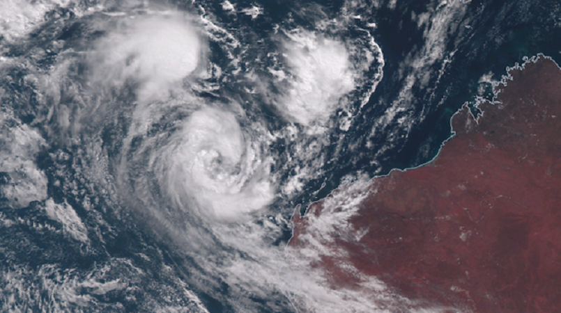
The destructive core of tropical cyclone Seroja is moving inland north of Geraldton in Western Australia after wind gusts of up to 170km/h were reported during landfall.
The storm hit the Western Australian coast south of Kalbarri at 8.00pm AWST on Sunday as a category three system.
At 10.00pm AWST the storm weakened to a category two system as it continued moving inland.
Cyclone Seroja is travelling at around 55km/h and significant impacts are expected to extend south and inland through to Wheat Belt communities overnight.
The cyclone will weaken as it moves further inland today but is still likely to result in damaging wind gusts and heavy rain.
A severe weather warning is current for areas to the southeast of the Tropical Cyclone Warning area.
The Bureau of Meteorology's Todd Smith said the cyclone was expected to cross the coast as a category two but had intensified.
"Even though we had anticipated the system to weaken a little bit, because waters off Kalbarri, Geraldton way are a little bit cooler than further north ... the system has maintained if not even intensified.
"So it's maintaining category three cyclone intensity."
Smith said very damaging winds were likely for a few hours, with gale force winds lasting longer.
A red alert has been extended to include an area south of the Carnarvon townsite to Lancelin, including the City of Greater Geraldton and Shires of Carnamah, Coorow, Chapman Valley, Irwin, Mingenew, Morawa, Northampton, Perenjori, Shark Bay and Three Springs.
Department of Fire and Emergency Services Commissioner Darren Klemm said towns within the red alert area would experience the impact of the cyclone until after midnight.
"You cannot go outside your home," Commissioner Klemm said.
"People must stay inside and activate your emergency plan.